 http://alabamamaps.ua.edu/historicalmaps/counties/macon/Cadastrals/index.htm
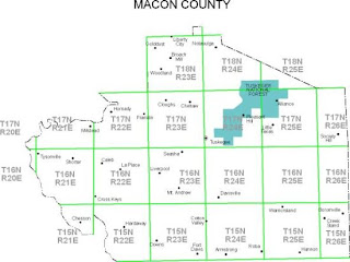
The above is a Cadastral map illustrating the Macon County Property Ownership, 1936.
A Cadastral map is basically used to divide land for development, ownership and boundaries.
No comments:
Post a Comment