 www.idwr.idaho.gov/gisdata/tech_note/adjudica.htm
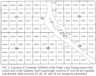
 The above is an example of a PLSS map of a portion of a Idaho Township. Typically a township is 6 sq miles, which is subdivided into 36 different 1 sq mile sections.
A Public Land Survey System map or PLSS map is a map that the Federal Government uses to identify and illustrate public domain land that is owned by the government.
No comments:
Post a Comment