 http://pthbb.org/natural/footprint/img/cartogram.png
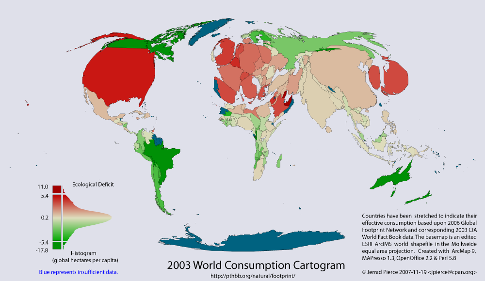
Above is the 2003 WorldConsumption Cartogram. Based on the 2006 Global Footprint Network and corresponding 2003 CIA World Fact Book data. The basemap is an edited ESRI ArcIMS world shapefile in Mollweide equal area projection. Created with ArcMap9, MAPresso 1.3, Open Office 2.2. & Perl 5.8 Jerrad Pierce 2007-11-19 jpierce@cpan.org
A Cartogram is a map which employs abstract illustrations that are not to scale in order to represent detailed statistical data.
No comments:
Post a Comment