 http://www.rrcap.unep.org/centralasia/reapreport/Map/MOUNTAIN/map_2.jpg
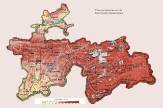
Above is a Hypsometric map of Tajikistan ; the dark red color represents the highest elevations, while the green represents. A Hypsometric map is a map that is used to illustrate topographic surveys. This type of map displays the different elevations by different means; such as shading, coloring, tinting or even contours.
No comments:
Post a Comment